Our Home

Our Home

Friday, June 26, 2015

Circle Tour - To Salmon, Challis & Custer Motorway Adventure Road

We took another two day, overnight, circle trip, Thursday (6/18) and Friday. We drove northwest through the Lemhi River Valley (US 28) to the town of Salmon.  We then followed the Salmon River Gorge south to Challis for the night. Friday morning we visited the ghost town of Bayhorse and followed the 43 mile Custer Motorway Adventure Road from Sunbeam back to Challis and then returned home.


Birch Creek Charcoal Kilns 1885-1889
Used in silver and lead smelting operations.

After lunch we visited the Sacajawea Interpretive,
Cultural and Educational Center
commemorating her role in the
Lewis and Clark Expedition.

Sacajawea Interpretive Center

Challis Hot Springs Bed & Breakfast
Originally this boarding house was developed in 1890
to support the local mining operations.

Two natural hot spring pools are located on the property.
Hot water bubbles up through the gravel bottom at
a rate of three cubic feet per second.

The mining ghost town of Bayhorse is now
operated by the Land of the Yankee Fork State Park.

In 1872  a lead-silver vein was discovered that resulted in
the creation of the Bayhorse Mining District in 1877.
In the end the town reached a population over 300.
Over 100,000 tons of ore was removed.
The Custer Motorway Adventure Road, also known as the Yankee Fork Historic Mining District Driving Tour, was the original Toll Road, constructed in 1878. This 43 mile one lane gravel road takes travelers past numerous historic and scenic vistas between Custer and Challis. Along the way we passed the ghost towns of Bonanza and Custer as well as the Yankee Fork Gold Dredge.
 
The Dredge operating between 1940 and 1952, began a new era of gold mining on the Yankee Fork, a tributary of the Salmon River, and remains the only floating dredge in Idaho. The four story dredge dug into the river valley for a distance of six miles, recovering gold by washing and separating the rock, gravel and dirt. This operation made a tremendous mess of this valley by leaving miles of dredge tailings, but this is all part of Idaho history.

Yankee Fork Gold Dredge Museum

This is a giant rock tumbling washing machine.
Everything 3/8 inch was retained, with larger pieces ejected.
The abandoned mining town of Custer once
had a population of over 600 residents.
Returning to Challis for a nice dinner at the
Tea Cup Café

Wednesday, June 24, 2015

Circle Tour - To Twin Falls, Sun Valley, Stanley & Challis


Home Sweet Home
It's really nice having a roof over our 5'er.
 
We took a two day, overnight, circle trip, Thursday (6/11) and Friday. First we headed southwest to the Twin Falls area. Friday we continued north through Sun Valley and into the Sawtooth Recreation Area and the mountain town of Stanley before turning back toward home through the Lost River Valley and right past Idaho's tallest Peak, Mt. Borah (el. 12,662).
 
Our first stop was a picnic lunch at Malad Gorge State Park. People pass by on the Interstate in a blink of an eye never suspecting this 250 foot deep gorge close by.
Our next stop was at Hagerman Fossil Beds National Monument. The major attraction here is the remains of over 200 species of plants and animals that have been found in the park, including complete skeletons of the Hagerman Horse, a zebra-like ancestor of today's horse. There are also deep wagon ruts left behind from the Oregon and Emigrant Wagon Trails.


Driving Highway US 30 East
Traveling the Niagara Springs State Park Trail,
where a thousand falls flow out of the cliff face.

Delicious homemade ice cream at the Clover Leaf
Creamery in Buhl, Idaho.
The Perrine Bridge at Twin Falls, Idaho, is a truss arch four-lane bridge that carries US 93 over the Snake River Canyon. Perrine Bridge is 1,500 long and 486 feet above the Snake River. The bridge is a popular, and legal, BASE jumping site. We watched a number of jumpers dive over the edge. This section of the Snake River is also famous for the dirt ramp, still visible, where Evil Knievil unsuccessfully attempted to jump the Snake River in 1974. While in Twin Falls we also visited the Shoshone Falls and the Twin Falls, for which the town was named.


The Beautiful Town of Sun Valley

Sawtooth Scenic Route

Frank Church Scenic Overlook
near Galena Peak

Redfish Lake, south of Stanley

Salmon River Gorge at Sunbeam Hot Springs
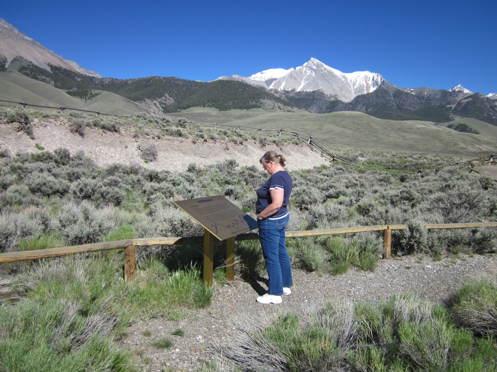
Our last stop was unplanned but very interesting. In October, 1983, a 7.3 earthquake formed a 21 mile long scarp near the base of Borah Peak. The movement of the rupture was up and down and is called a "high angle dip slip fault." This is clearly visible in the foreground of the picture with snow covered Borah Peak in the background. This earthquake dropped the valley 7 1/2 feet, raised the mountain over a foot and caused new springs and craters to develop. More than 400 billion gallons of water gushed from the ground. The quake did over $15,000,000 of damage to roads and the surrounding towns.

Thursday, June 4, 2015

Craters of the Moon National Monument

Less than a 100 mile drive from Camas NWR lies the 750,000 acre national monument called Craters of the Moon. It received its name at the beginning of the 20th century when locals referred to the area as "craters of the moon." We now know better, as this was before Neil took his first step on the lunar surface.
There is a seven mile loop road that provides access to hiking trails, lava tube caves and viewpoints. The most recent eruption occurred a mere 2,000 years ago, and geologists believe that future events are likely.
The park was fully adorned in wildflowers during
our late May visit.

A short but steep 1/2 mile trail leads to the
top of Inferno Cone
From here you can see the cinder cones lined
up along the Great Rift and a great 360° view.
Indian Tunnel Lava Tube

Saturday, May 23, 2015

Yellowstone NP Before the Rush

After our first full week here, we took a three day weekend trip to Yellowstone National Park. West Yellowstone, Montana, is about 110 miles northeast of Camas NWR.
On our way to the Park, we followed the Mesa Falls Scenic Bypass (SH-47) that parallels US 20.  

Upper Mesa Falls
Geysers Everywhere
Mammoth Hot Springs 
Home for Two Nights in Mammoth Hot Springs Village
Church Volunteers Tending the Lawn
Grand Prismatic Spring
Old Faithful Inn
Where we Enjoyed Lunch Each Day
It was very nice and reasonably priced.
Crested Pool in Upper Geyser Basin
There She Blows
Old Faithful
Erupts Approximately Every 90 Minutes
Yellowstone Canyon
and the Lower Falls
We did see three black bears, a cub and one grizzly.
We only got a good picture of this one.
The last morning we awoke to seven inches of fresh snow.
What a treat to see the Park in its winter coat.
Who would have thought a snowball fight in mid-May.
We enjoyed watching them melt in the hot pools.
Norris Geyser Basin trails were beautiful but not busy.

Wednesday, May 13, 2015

First Work Week at Camas

Well, we made it through the first week. As always the first week is challenging as we settle in and orient ourselves to both the area and the refuge. All refuges are similar yet each is unique. 
 
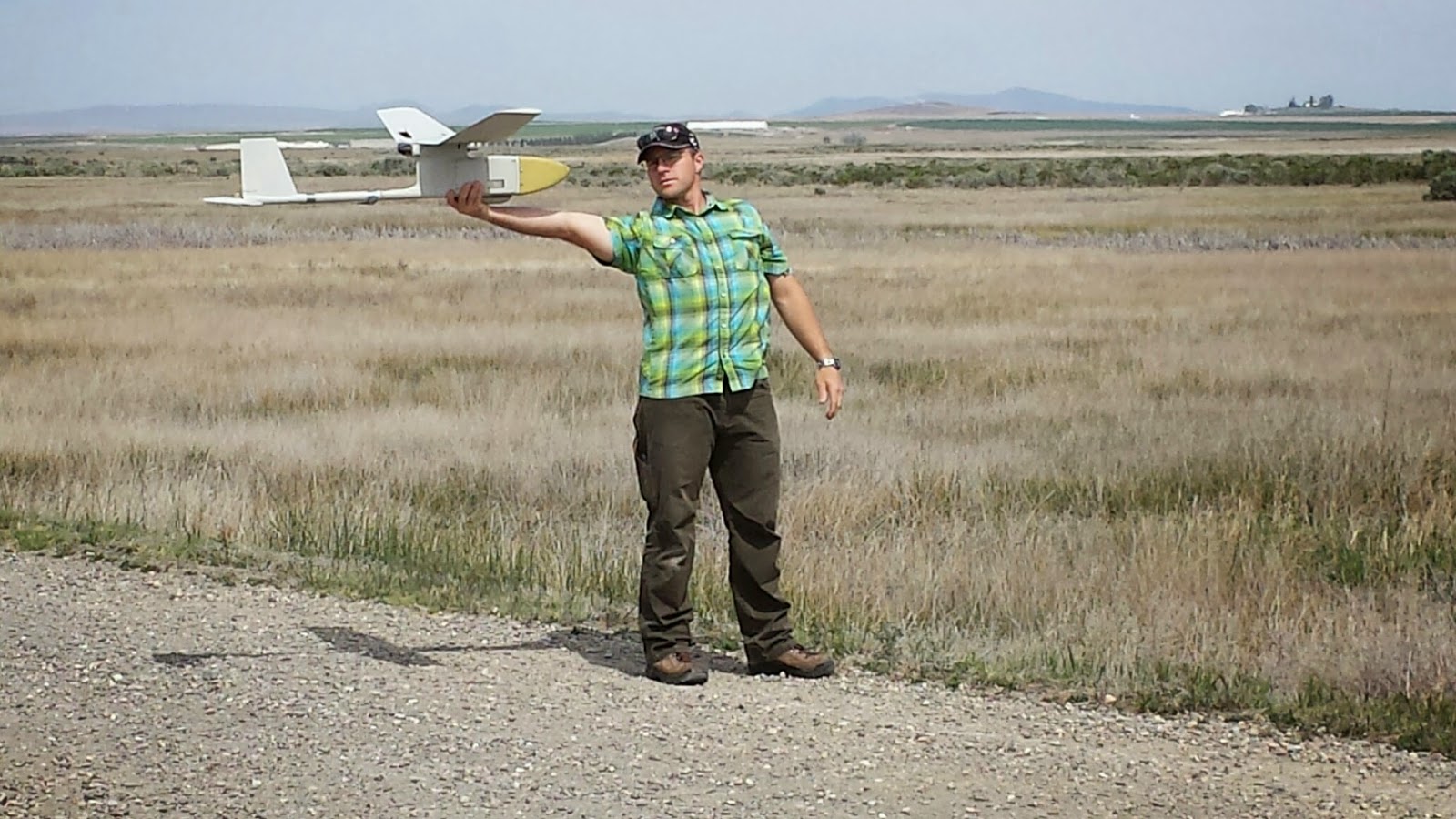
Monday USGS came out to assess the effectiveness of drone surveys versus fixed wing aircraft surveys of Trumpeter Swan nesting. This is the first time a drone has been flown on the refuge. They assembled the army surplus drone and tested it by flying quadrants  for about three hours. We were invited to observe the test.
 
Drone Assembly
Launch
Flight Operations
Each Tuesday we follow a specific route through the many miles of refuge two-track roads surveying large mammals and certain birds of interest as well as any newborns. This is also a good time to check on two Bat Monitor stations, changing the batteries and flash cards that record the bat echoes. 
 
Tuesday and Wednesday afternoons we are responsible for setting 45 small mammal traps. These traps are laid out in grids of nine each. The five 100 foot square grids are placed in areas of the refuge as determined by the biologist. These grids are moved each week. Wednesday and Thursday mornings a group of local volunteers come to open each trap, identify the small mammal captured, record data gathered, mark them with White-Out, and release them.
 
Daily we read gages and record water levels in the ponds, which are maintained by ground water pumps.
 
Female Elk has Seen Better Days
Small Mammal Survey Results
Checking Pond Levels
Sawtooth Mountain Range in the Background
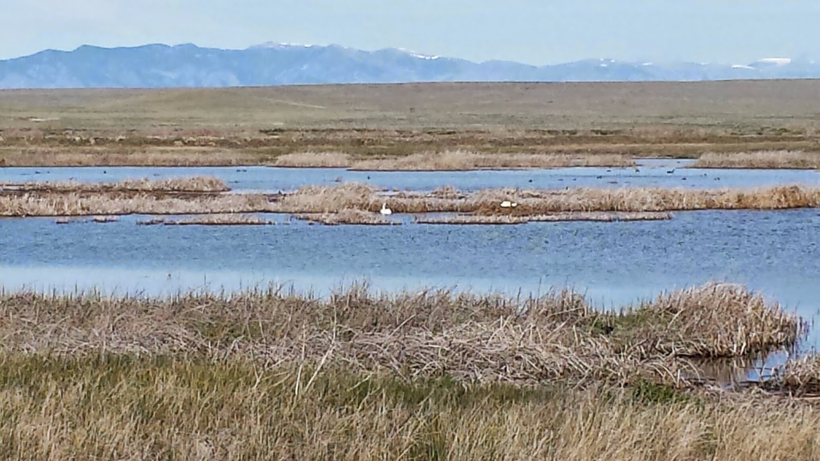
Nesting Trumpeter Swan Pair